Article 8 — Acceptance
These Terms of Use set forth the conditions under which you may access and use the Services and all the functionalities provided therein.
By accessing or using the Services, you agree to be bound by these Terms of Use. You represent and warrant that you have the ability and means required to access and use the Services, and you acknowledge that you have read, understood, and accepted, without limitation or reservation, these Terms of Use and the Privacy Policy above.
Please review these Terms of Use carefully before using the Services. If you do not agree with them, please do not use the Services.
These Terms of Use apply to you from your first access to the Services.
Article 9 — What these Terms cover
These Terms of Use govern the Website and the Project’s collection on the Platform. They do not replace HEIG-VD’s data policy, which governs the Platform itself and to which you also agree when you use Smapshot. Where the two conflict in respect of the Platform, HEIG-VD’s provisions prevail, and the Project’s obligations to you extend only as far as its own control over the Services reaches.
Article 10 — The Services
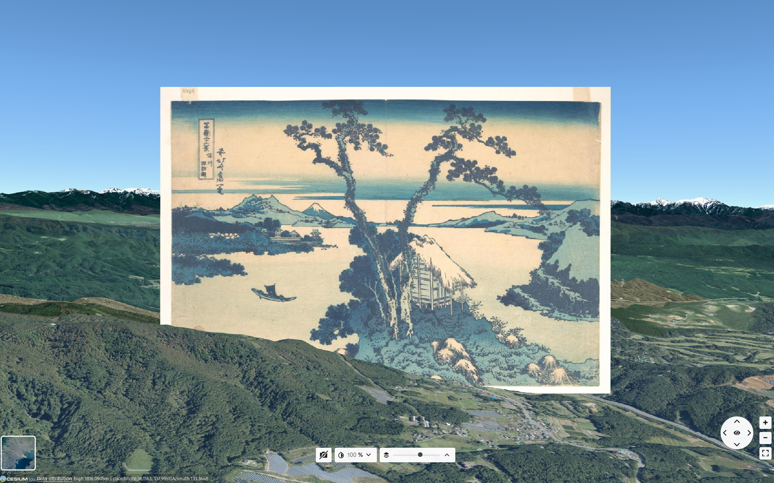
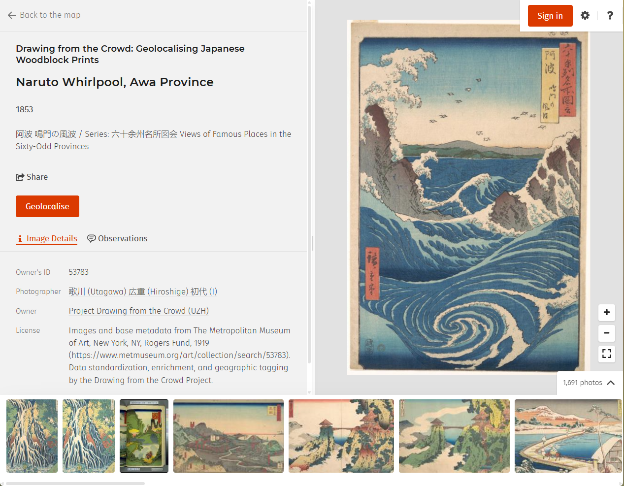
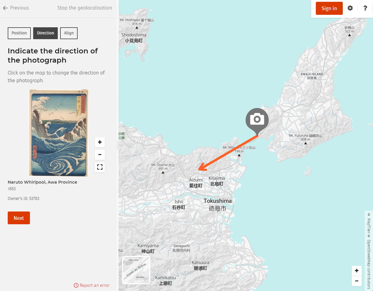
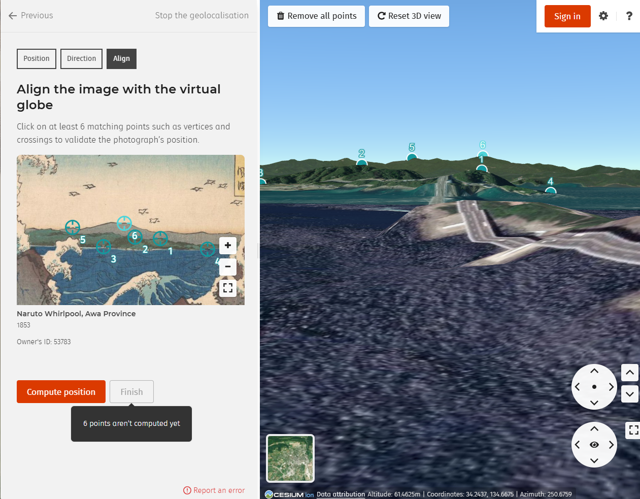
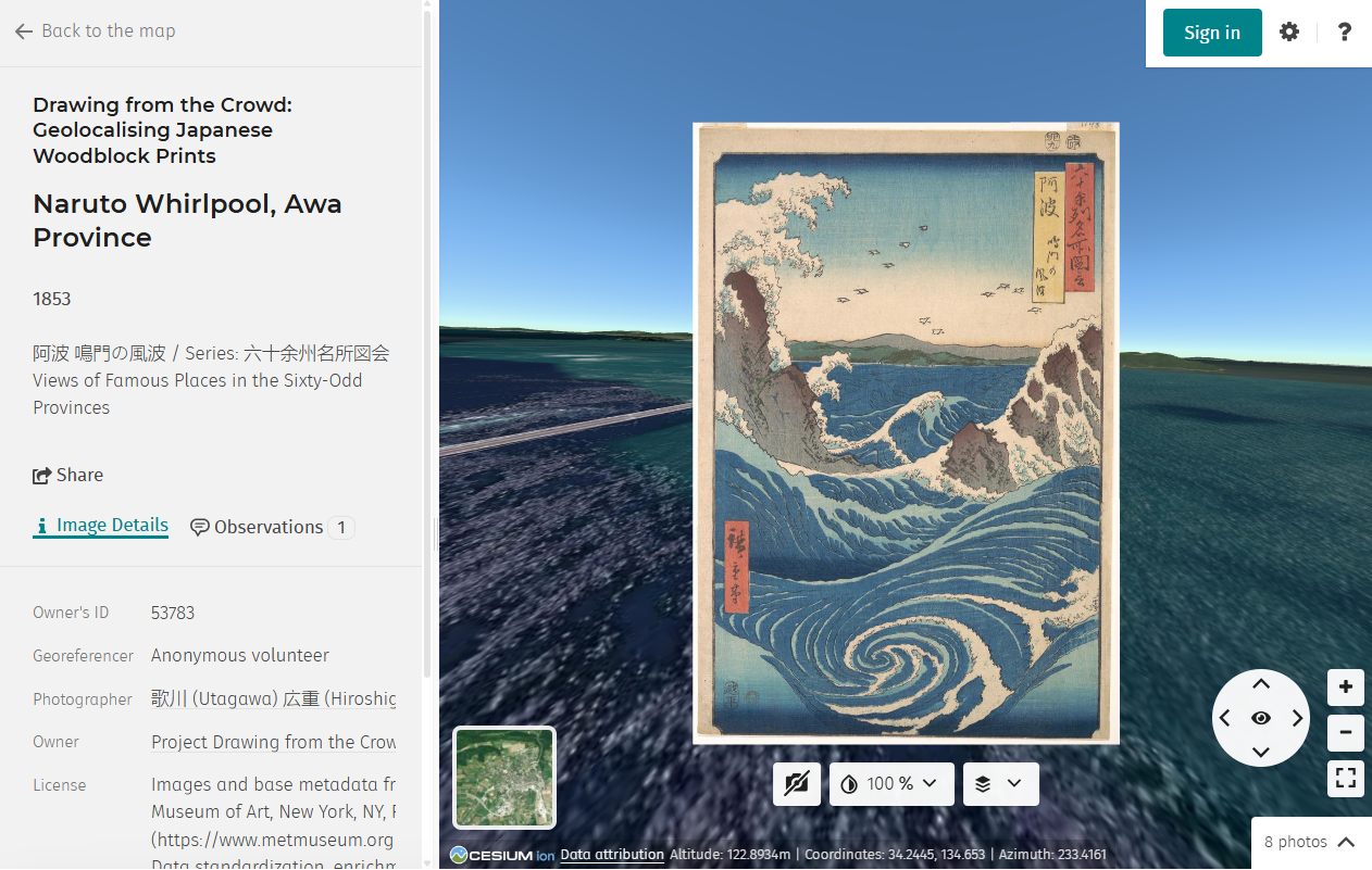
The Services allow you to view digitised ukiyo-e prints, to identify the viewpoint from which each depicted scene would have been seen, to align the depicted terrain with modern 3D terrain models, and to record observations about the relationship between the depiction and the underlying geography. Contributions are reviewed by the Project’s Principal Investigator before being incorporated into the research dataset, and feedback may be given by comment.
The Services are made available free of charge, excluding any connection costs, which depend on your electronic communications provider. It is your responsibility to have the hardware, software, browser configuration, and internet access required to use the Services, and to bear the cost of them.
Article 11 — Participation and accounts
No account is required. You may browse and contribute anonymously. An account lets you track your own contributions and receive feedback on them, but it is optional, and even when signed in you may choose to contribute anonymously.
Where you do create an account, it is created and held by HEIG-VD. You agree to provide accurate and complete information when creating or updating it, and to keep your login credentials confidential. You are responsible for activity carried out through your account. If you believe your account is being used by someone else, tell HEIG-VD at and the Project promptly.
Participation by minors. The Services are designed for adult contributors, and participation by minors (persons under 18) is not encouraged. The tasks are demanding and are not directed at children. The Project carries out no age check, since a contributor who works anonymously provides no personal data to anyone. A minor who nevertheless wishes to take part should do so with the agreement of a parent or guardian. Registration is HEIG-VD’s, and their terms govern who may open an account.
Article 12 — Intellectual property: Collection Images, terrain, and Project Content
The Collection Images are not the property of the Project. Each is held by an institution which sets its own terms for it, and those terms differ from one another. The Project does not restate them here: restating another party’s licence is how a statement of it goes quietly out of date. The holding institutions are listed under About. Each institution’s own declaration is the authority on what may be done with its images.
Before reproducing, republishing, or otherwise reusing any Collection Image outside the Services, consult the declaration of the institution that holds it. The Project makes no representation and gives no warranty as to your right to reuse any Collection Image.
Every image in the collection is one the Project is entitled to make available: photographs are included only where they are out of copyright, and all other material has been integrated under terms that permit at least educational use. The holding institution’s declaration remains the authority on what you, in turn, may do with an image outside the Services.
Terrain data is supplied by the Geospatial Information Authority of Japan (GSI) and is subject to GSI’s terms of use.
Project Content belongs to the Project or its licensors and is protected by copyright and other intellectual property laws. You are granted a limited, non-exclusive, non-transferable, revocable licence to use the Services and Project Content for personal, non-commercial, educational, and research purposes. All rights not expressly granted are reserved.
You may not use the name ThePrintLab, the name of the Project, or the marks or logos of the Project’s funders and partners without prior written permission.
Article 13 — Your Contributions
Contributions are not all of one kind, and rights in them do not all sit in one place.
Georeference data — camera position, orientation, and the point correspondences from which the Platform computes them — is measurement. It records where a viewpoint lies, and it is arrived at through the Platform’s mechanism operating on the points you identify. Copyright protects original expression, not facts, measurements, or results dictated by the function that produces them. The Project therefore does not treat georeference data as anyone’s literary property, and neither claims it nor asks you to give it up. It is data, and it is published as open data.
Written material — observations, research comments, and any recollections you choose to share — is different. It is expression, and it is yours. By submitting it, you grant the Project a non-exclusive, royalty-free licence to reproduce, quote, and publish it for non-commercial research and educational purposes, with attribution to your username. You may withdraw this licence for future use at any time; material already published cannot be unpublished.
The assembled dataset — the collection of verified georeferences, the metadata around them, and the structure imposed on them — results from the investment of the Project and of HEIG-VD. Any rights subsisting in the compilation, as distinct from its contents, belong to them.
All Contributions submitted through the Platform are published by HEIG-VD on Smapshot and through the Smapshot Open Data API, and, as HEIG-VD’s data policy provides, may be used by partners in their research projects. The Project is such a partner, and its use rests on that publication.
Where you contribute while signed in and without selecting the anonymous option, you agree that the Project may credit you by username in research publications, datasets, presentations, and teaching materials. Credit already given in published work cannot be withdrawn; you may ask at any time not to be credited in future work, or contribute anonymously.
Publication through the Platform is governed by HEIG-VD’s data policy. The research dataset the Project derives and publishes from those Contributions carries its own licence, stated in the Project’s data repository.
You represent and warrant that you own the rights in your Contributions, or are licensed to submit them, and that they do not infringe the rights of any third party. You agree to indemnify and hold the Project harmless against claims by third parties arising from your Contributions.
Contributions are treated as non-confidential. Do not submit anything you are not willing to see published.
Article 14 — Rules of conduct
You must not submit, post, or distribute through the Services any content that is unlawful, defamatory, obscene, hateful, harassing, misleading, or that infringes the rights of any third party.
Personal information in Contributions. Contributions are published openly (Article 4). Share only what you are content to see published under your username or anonymously, and remember that open data is copied and cannot be recalled.
Contributions are for observations about the depiction and the terrain. Please do not submit personal recollections, or personal information about yourself or anyone else — and in particular do not submit health information, or information revealing religious, political, or philosophical beliefs, ethnic origin, or sexual orientation. The Project does not collect this material and has no basis to hold it. If you have a recollection of a place that bears on a Collection Image, the Project would be glad to hear it by email rather than through the Platform: .
You must not defame, stalk, bully, abuse, harass, threaten, impersonate, or intimidate any person through the Services.
You must not create an account by automated means, or use a script, bot, crawler, or scraper to submit Contributions. Automated submission defeats the purpose of the exercise, which is human observation.
You may make non-commercial use of the Services only. You must not probe, scan, or test the vulnerability of any system, interfere with security measures, or disrupt the operation of the Services.
Article 15 — Review, moderation, and removal
Every Contribution is reviewed by the Project’s Principal Investigator before being incorporated into the dataset. Verification may take time; a Contribution that does not appear on the map immediately has not been rejected. Where a Contribution needs correction, feedback is given by comment. Unsuccessful attempts are retained, since they are themselves evidence about which prints resist location.
The Project reserves the right, but assumes no obligation, to edit, remove, or decline any Contribution, and to suspend or terminate participation where these Terms of Use are breached. If you see content on the Services that you believe breaches these Terms, please write to with the date, a description of the content, and your reasons.
Article 16 — Disclaimers and liability
The Services and their content are provided “as is”, without warranties of any kind, express or implied, and in particular without any warranty that the material available through them is complete or accurate. The Project is a research project, not a reference work; the georeferences it publishes are scholarly interpretations, subject to revision, and are not authoritative statements of historical or geographical fact.
The Project is not responsible for your device, your internet connection, or any technical problem arising from either. The Project does not endorse any Contribution, and the views expressed by Contributors are their own.
To the fullest extent permitted by applicable law, the Project is not liable for any indirect, incidental, consequential, special, or punitive damages arising from your use of or inability to use the Services. No monetary cap is placed on the Project’s liability. Nothing in these Terms excludes liability that cannot lawfully be excluded, including liability for death or personal injury caused by negligence, or for fraud, wilful misconduct, or gross negligence.
Article 17 — External links
The Services link to websites operated by third parties. The Project does not endorse and accepts no responsibility for the content of those sites, and cannot be held liable for any damage arising from your use of them. A link does not imply affiliation.